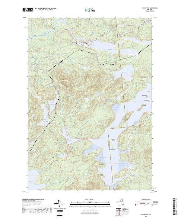
2023 Map of Piercefield
USGS Topo · Published 2023About this map
The Adirondack Park dominates this landscape, where the St. Lawrence and Franklin county line crosses the waters of Raquette Pond. The hamlet of Piercefield serves as a northern anchor along the Piercefield Flow, while the smaller settlement of Conifer sits to the southwest near Dead Creek. This terrain is defined by its complex hydrography, featuring numerous remote water bodies like Eagle Crag Lake and Mount Arab Lake nestled at the base of Arab Mountain.
Find a feature on this map
59 named features on this map. Tap any name to fly to it.
Don’t see what you’re looking for? This feature index may not catch every label — zoom into the map to look around manually.
Map Details
Editions of this 2023 Piercefield Map
This is the sole edition of this map. No revisions or reprints were ever made.
Other maps of this area

1904 · Long Lake
USGS Topo · 1:62,500

1905 · Saint Regis
USGS Topo · 1:62,500

1907 · Tupper Lake
USGS Topo · 1:62,500

1920 · Childwold
USGS Topo · 1:62,500

1921 · Childwold
USGS Topo · 1:48,000

1922 · Childwold
USGS Topo · 1:62,500

1948 · Ogdensburg
USGS Topo · 1:250,000

1951 · Ogdensburg
USGS Topo · 1:250,000

1953 · Ogdensburg
USGS Topo · 1:250,000

1954 · Tupper Lake
USGS Topo · 1:62,500