
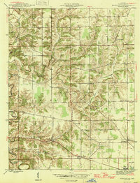
1946 Map of Pierceville
USGS Topo · Published 1946About this map
Milan and Old Milan anchor the southeastern corner of this mid-century Ripley County landscape, where the Baltimore and Ohio railroad cuts a definitive line across the southern township of Franklin. The terrain is characterized by the deep, dendritic drainages of Laughery Creek and its tributaries, which forced a scattered development pattern of small crossroads and rural institutions. Significant local landmarks include numerous parish centers such as St Nicholas Ch and St Pius Ch, reflecting the community's early social organization. The transition from the older settlement at Old Milan to the rail-oriented Milan illustrates the shifting economic focus of the era. Smaller, family-named locales like Behlmer Corner and Stumpke Corner dot the map, alongside several burial grounds including Pratsburg Cem and Adams Cem, providing valuable touchpoints for genealogical research.
Find a feature on this map
26 named features on this map. Tap any name to fly to it.
Don’t see what you’re looking for? This feature index may not catch every label — zoom into the map to look around manually.
Map Details
Editions of this 1946 Pierceville Map
2 editions found
Other maps of this area

1946 · Versailles
USGS Topo · 1:24,000

1946 · Milan
USGS Topo · 1:24,000

1946 · Batesville
USGS Topo · 1:24,000

1946 · Osgood
USGS Topo · 1:24,000

1946 · New Point
USGS Topo · 1:24,000

1953 · Cincinnati
USGS Topo · 1:250,000

1957 · Cincinnati
USGS Topo · 1:250,000

1958 · Spades
USGS Topo · 1:24,000

1958 · Sunman
USGS Topo · 1:24,000

1958 · Dillsboro
USGS Topo · 1:24,000