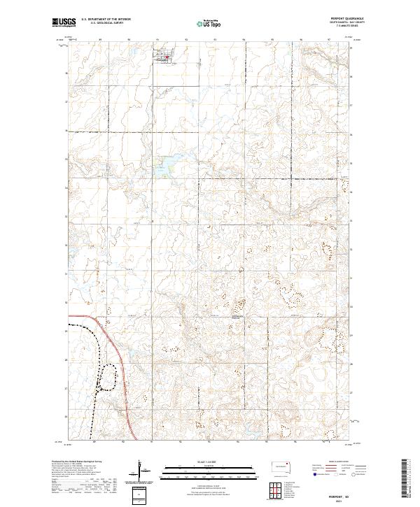
2021 Map of Pierpont
USGS Topo · Published 2021About this map
Pierpont anchors the northern edge of this agricultural landscape in Day County, where the town's grid meets the surrounding prairie terrain. The map captures the village's layout, including local thoroughfares like 4th St, as it transitions into the open country. Just to the south, the waters of Pierpont Lake provide a notable geographical break in the township, marking a significant local water feature in a region defined by its glacial heritage. This area is part of the Coteau des Prairies, a high plateau characterized by its undulating surface and numerous small wetlands. The survey reflects the enduring section-line road system that organizes the rural South Dakota plains, documenting the contemporary interface between small-town settlement and the vast upland geography.
Find a feature on this map
4 named features on this map. Tap any name to fly to it.
Don’t see what you’re looking for? This feature index may not catch every label — zoom into the map to look around manually.
Map Details
Editions of this 2021 Pierpont Map
This is the sole edition of this map. No revisions or reprints were ever made.
Other maps of this area

1953 · Milbank
USGS Topo · 1:250,000

1958 · Milbank
USGS Topo · 1:250,000

1958 · Britton 4 SW
USGS Topo · 1:24,000

1958 · Andover
USGS Topo · 1:24,000

1958 · Andover SW
USGS Topo · 1:24,000

1958 · Langford
USGS Topo · 1:24,000

1958 · Pierpont
USGS Topo · 1:24,000
1958 · Langford SW
USGS Topo · 1:24,000

1973 · Lynn Lake
USGS Topo · 1:24,000

1973 · Bristol West
USGS Topo · 1:24,000