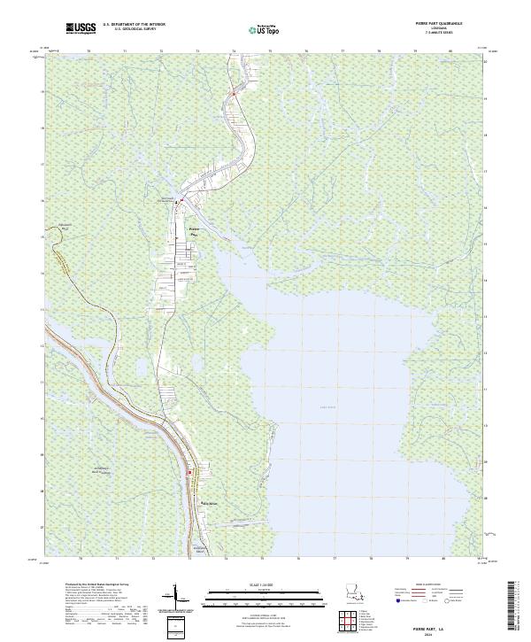
2024 Map of Pierre Part
USGS Topo · Published 2024About this map
Pierre Part and the surrounding wetlands of Assumption Parish define this landscape where the Atchafalaya Basin Floodway meets a network of natural and engineered water passages. The settlement pattern is strictly dictated by the hydrology, with residential streets like Agnes St and James St clustered along the high ground of Bayou Pierre Part. This geography is a testament to the local water-based economy, showing the vital connection between Lake Verret and the broader basin via the Gulf Intracoastal Waterway.
Find a feature on this map
48 named features on this map. Tap any name to fly to it.
Don’t see what you’re looking for? This feature index may not catch every label — zoom into the map to look around manually.
Map Details
Editions of this 2024 Pierre Part Map
This is the sole edition of this map. No revisions or reprints were ever made.
Other maps of this area

1935 · Chicot Lake
USGS Topo · 1:62,500

1936 · White Castle
USGS Topo · 1:62,500

1945 · New Orleans
USGS Topo · 1:250,000

1948 · Foster
USGS Topo · 1:62,500

1953 · Napoleonville
USGS Topo · 1:62,500

1954 · Chicot Lake
USGS Topo · 1:62,500

1954 · Baton Rouge
USGS Topo · 1:250,000
1955 · Chicot Lake
USGS Topo · 1:62,500

1956 · Baton Rouge
USGS Topo · 1:250,000

1959 · Foster
USGS Topo · 1:62,500