
2010 Map of Pierrepont
USGS Topo · Published 2010About this map
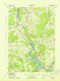
Pierrepont and its surrounding hamlets are defined by a network of drainage streams flowing toward the Little River and Grannis Brook. This rural landscape in Saint Lawrence County retains a layout of crossroads settlements and family-named landmarks that have persisted through generations. The distribution of sites like Crary Mills and Langdon Corners reflects a mid-19th-century settlement pattern where small community centers provided services to outlying farmsteads.
Find a feature on this map
22 named features on this map. Tap any name to fly to it.
Don’t see what you’re looking for? This feature index may not catch every label — zoom into the map to look around manually.
Map Details
Editions of this 2010 Pierrepont Map
This is the sole edition of this map. No revisions or reprints were ever made.
Other maps of this area

1908 · Potsdam
USGS Topo · 1:62,500

1910 · Canton
USGS Topo · 1:62,500

1911 · Canton
USGS Topo · 1:62,500

1915 · Russell
USGS Topo · 1:62,500

1918 · Russell
USGS Topo · 1:62,500

1921 · Stark
USGS Topo · 1:62,500

1923 · Stark
USGS Topo · 1:62,500

1940 · Stark
USGS Topo · 1:62,500

1943 · Potsdam
USGS Topo · 1:31,680
1943 · Colton
USGS Topo · 1:31,680