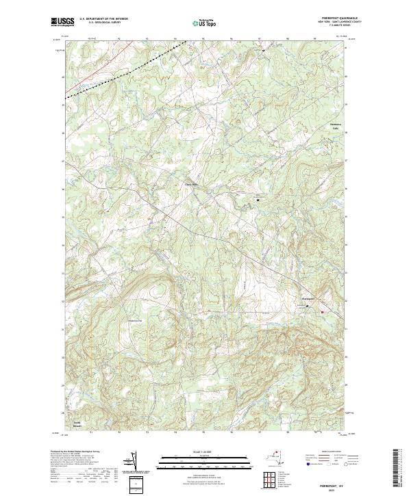
2023 Map of Pierrepont
USGS Topo · Published 2023About this map
Pierrepont and Hannawa Falls anchor this survey of the St. Lawrence County landscape, characterized by the convergence of several significant watercourses and family-named routes. The Little River and Boyden Brook wind through the southern sections, while Grannis Brook and Tracy Brook drain the northern reaches, illustrating the hydrological network that shaped local settlement patterns. High ground at Waterman Hill provides a vantage over the surrounding territory, which remains defined by its rural crossroads and agricultural history.
Find a feature on this map
68 named features on this map. Tap any name to fly to it.
Don’t see what you’re looking for? This feature index may not catch every label — zoom into the map to look around manually.
Map Details
Editions of this 2023 Pierrepont Map
This is the sole edition of this map. No revisions or reprints were ever made.
Other maps of this area

1908 · Potsdam
USGS Topo · 1:62,500

1910 · Canton
USGS Topo · 1:62,500

1911 · Canton
USGS Topo · 1:62,500

1915 · Russell
USGS Topo · 1:62,500

1918 · Russell
USGS Topo · 1:62,500

1921 · Stark
USGS Topo · 1:62,500

1923 · Stark
USGS Topo · 1:62,500

1940 · Stark
USGS Topo · 1:62,500

1943 · Potsdam
USGS Topo · 1:31,680
1943 · Colton
USGS Topo · 1:31,680