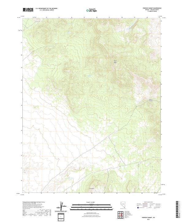
2021 Map of Pierson Summit
USGS Topo · Published 2021About this map
Wilson Creek Range dominates this corner of Lincoln County, defining a landscape shaped by high-elevation crests and vital water sources. The map centers on Pierson Summit, a key navigational point within this complex terrain. The availability of water in an otherwise arid environment is clearly documented through a network of named seeps and springs, including Coal-Burner Spring, Buster Spring, and Willow Spring. These features, alongside Buster Wash, suggest a geography that has historically dictated the movement of people and livestock through the range. To the south, the Red Buttes provide a distinct geological contrast to the northern ridges. This 2021 survey illustrates the continued importance of these named landmarks for modern land management and recreation in the Great Basin region.
Find a feature on this map
13 named features on this map. Tap any name to fly to it.
Don’t see what you’re looking for? This feature index may not catch every label — zoom into the map to look around manually.
Map Details
Editions of this 2021 Pierson Summit Map
This is the sole edition of this map. No revisions or reprints were ever made.
Other maps of this area

1885 · Pioche
USGS Topo · 1:250,000

1886 · Pioche
USGS Topo · 1:250,000

1921 · NW 1/4 Panaca
USGS Topo · 1:48,000

1953 · Pioche
USGS Topo · 1:24,000

1954 · Caliente
USGS Topo · 1:250,000

1956 · Lund
USGS Topo · 1:250,000

1959 · Caliente
USGS Topo · 1:250,000

1960 · Lund
USGS Topo · 1:250,000
1970 · Mt. Wilson SW
USGS Topo · 1:24,000
1970 · Mt. Wilson
USGS Topo · 1:24,000