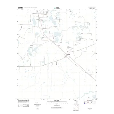
2012 Map of Pierson
USGS Topo · Published 2012About this map
Pierson serves as a central hub in this part of Volusia County, defined by its agricultural layout and numerous water bodies like Lake Pierson and Shaw Lake. The landscape is dotted with several small communities including Eldridge, Emporia, and Barberville, each connected by a grid of local roads and the primary corridor of US Route 17. The high concentration of local burial grounds, such as Mount Zion Primitive Baptist Cem and Ebenezer Lutheran Cem, suggests a deeply rooted local history and established family lineages.
Find a feature on this map
104 named features on this map. Tap any name to fly to it.
Don’t see what you’re looking for? This feature index may not catch every label — zoom into the map to look around manually.
Map Details
Editions of this 2012 Pierson Map
This is the sole edition of this map. No revisions or reprints were ever made.
Other maps of this area

1954 · Daytona Beach
USGS Topo · 1:250,000

1958 · Daytona Beach
USGS Topo · 1:250,000

1962 · Lake Woodruff
USGS Topo · 1:24,000

1964 · Daytona Beach
USGS Topo · 1:250,000
1964 · De Land
USGS Topo · 1:24,000

1970 · Welaka SE
USGS Topo · 1:24,000

1970 · Seville
USGS Topo · 1:24,000

1970 · Pierson
USGS Topo · 1:24,000
1971 · Lake Dias
USGS Topo · 1:24,000
1972 · Astor
USGS Topo · 1:24,000