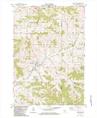
1984 Map of Pigeon Falls
USGS Topo · Published 1984About this map
The rolling coulee landscape of Trempealeau County and Jackson County is defined here by a dense network of valley-bottom roads and upland ridges. The village of Pigeon Falls serves as a central hub, situated where Hegge Coulee meets the winding Pigeon Creek. The map records a deeply rooted rural community, evidenced by several distinct burial grounds including the Hale Cem, Evangelical Cem, and Township Cem.
Find a feature on this map
34 named features on this map. Tap any name to fly to it.
Don’t see what you’re looking for? This feature index may not catch every label — zoom into the map to look around manually.
Map Details
Editions of this 1984 Pigeon Falls Map
This is the sole edition of this map. No revisions or reprints were ever made.
Other maps of this area

1926 · Whitehall
USGS Topo · 1:62,500

1927 · Blair
USGS Topo · 1:62,500

1927 · Strum
USGS Topo · 1:62,500

1929 · Whitehall
USGS Topo · 1:62,500

1930 · Strum
USGS Topo · 1:62,500

1935 · Osseo
USGS Topo · 1:48,000

1940 · Osseo
USGS Topo · 1:62,500

1953 · Eau Claire
USGS Topo · 1:250,000

1958 · Eau Claire
USGS Topo · 1:250,000

1964 · Eau Claire
USGS Topo · 1:250,000