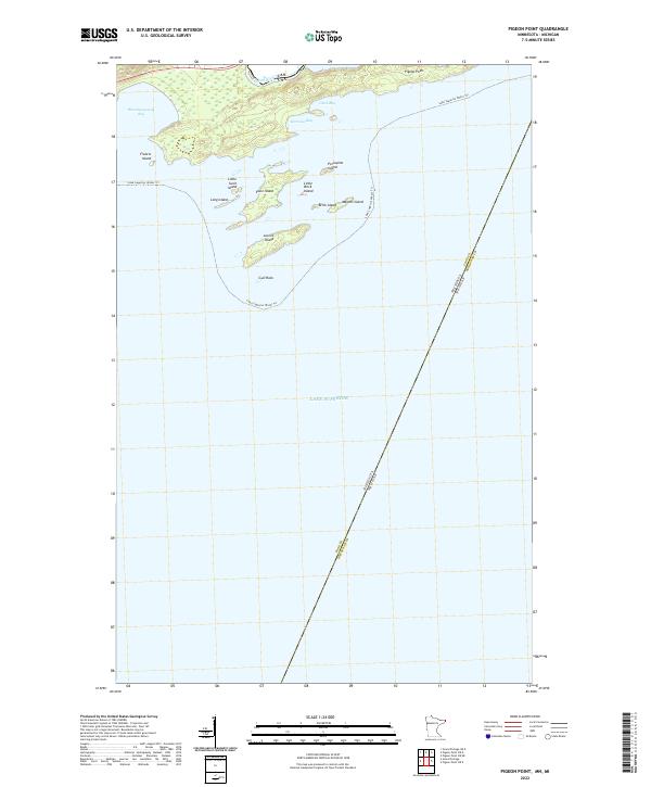
2022 Map of Pigeon Point
USGS Topo · Published 2022About this map
Pigeon Point forms a narrow, rocky finger extending into the cold waters of Lake Superior, marking a distinct northern corner of the border between the United States and Canada. The northern shore of this peninsula is defined by the Pigeon River, which serves as the international boundary line. To the south, an archipelago of small islands—including Susie Island, Lucille Island, and Magnet Island—parallels the coast, creating sheltered passages through Morrison Bay and Clark Bay. The landscape is largely defined by its maritime character, with the Lake Superior Water Trl skirting the jagged coastline. Further west, the broad sweep of Wauswaugoning Bay provides a natural harbor before the terrain breaks into the cluster of islands and shoals like Gull Rock. This recent survey captures the complex boundary lines where Cook County meets the Michigan state line in the open water.
Find a feature on this map
23 named features on this map. Tap any name to fly to it.
Don’t see what you’re looking for? This feature index may not catch every label — zoom into the map to look around manually.
Map Details
Editions of this 2022 Pigeon Point Map
This is the sole edition of this map. No revisions or reprints were ever made.
Other maps of this area

1958 · Hancock
USGS Topo · 1:250,000
1959 · Pigeon Point
USGS Topo · 1:24,000

1959 · Fort William
USGS Topo · 1:250,000
1959 · Grand Portage
USGS Topo · 1:24,000

1960 · Hancock
USGS Topo · 1:250,000

1961 · Hancock
USGS Topo · 1:250,000

1966 · Hancock
USGS Topo · 1:250,000

1968 · Fort William
USGS Topo · 1:250,000

1985 · Pigeon Point
USGS Topo · 1:100,000

1985 · Grand Portage
USGS Topo · 1:100,000