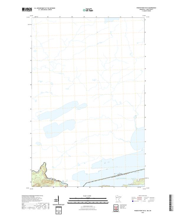
2022 Map of Pigeon Point OE N
USGS Topo · Published 2022About this map
Pigeon River forms the international boundary in this northern wilderness, winding toward its outlet at the edge of Lake Superior. The landscape is dominated by the aquatic geography of the borderlands, where the Canada-United States border cuts through Pigeon Bay. This survey captures the intricate shoreline features where land and water meet, including the passage at The Narrows and the secluded waters of Little Portage Bay. Land access is limited to a few corridors such as Teal Lake Rd and the Middle Falls Trl, reflecting a region defined more by its natural hydrology than by human development. Notable coastal landmarks like The Hole in the Wall emphasize the maritime character of this remote northern reach of Cook County.
Find a feature on this map
12 named features on this map. Tap any name to fly to it.
Don’t see what you’re looking for? This feature index may not catch every label — zoom into the map to look around manually.
Map Details
Editions of this 2022 Pigeon Point OE N Map
This is the sole edition of this map. No revisions or reprints were ever made.
Other maps of this area

1958 · Hancock
USGS Topo · 1:250,000
1959 · Pigeon Point
USGS Topo · 1:24,000

1959 · Fort William
USGS Topo · 1:250,000
1959 · Grand Portage
USGS Topo · 1:24,000

1960 · Hancock
USGS Topo · 1:250,000

1961 · Hancock
USGS Topo · 1:250,000

1966 · Hancock
USGS Topo · 1:250,000

1968 · Fort William
USGS Topo · 1:250,000

1985 · Pigeon Point
USGS Topo · 1:100,000

1985 · Grand Portage
USGS Topo · 1:100,000