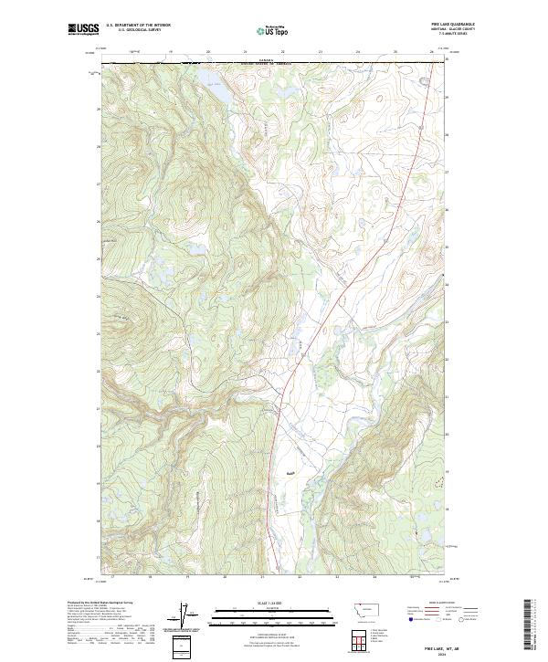
2024 Map of Pike Lake
USGS Topo · Published 2024About this map
Babb serves as the primary settlement in this northern Montana landscape, situated near the confluence of Kennedy Creek and the Saint Mary River. This modern survey illustrates a complex water management and natural drainage system, most notably the Saint Mary Canal, which skirts the eastern edges of the high terrain. The geography is defined by prominent ridges such as Swiftcurrent Ridge and Sandy Ridge, which rise above the river valleys. To the north, the terrain transitions toward the international border between Canada and the United States, with Pike Lake resting near the boundary line. The network of local roads, including Moccasin Flat Rd and Pike Lake Rd, provides a clear view of modern access routes through this high-elevation region of Glacier County.
Find a feature on this map
21 named features on this map. Tap any name to fly to it.
Don’t see what you’re looking for? This feature index may not catch every label — zoom into the map to look around manually.
Map Details
Editions of this 2024 Pike Lake Map
This is the sole edition of this map. No revisions or reprints were ever made.
Other maps of this area

1901 · Browning
USGS Topo · 1:125,000

1903 · Browning
USGS Topo · 1:125,000

1904 · Chief Mountain
USGS Topo · 1:125,000

1938 · Chief Mountain
USGS Topo · 1:125,000

1960 · Cut Bank
USGS Topo · 1:250,000

1963 · Cut Bank
USGS Topo · 1:250,000

1964 · Cut Bank
USGS Topo · 1:250,000

1968 · Babb
USGS Topo · 1:24,000
1968 · Duck Lake
USGS Topo · 1:24,000
1968 · Chief Mountain
USGS Topo · 1:24,000