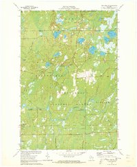
1971 Map of Pike Lake NW
USGS Topo · Published 1973About this map
The South Fork Flambeau River defines the central topography of this Northwoods landscape, winding past Little Cedar Rapids and Cedar Rapids within the Chequamegon National Forest. This early 1970s survey documents a region defined by its hydrography, where numerous glaciated basins have formed Newman Lake, Kabol Lake, and the smaller Nettie B Lake. The map reveals the early development of forest recreation, specifically around the Smith Rapids Campground and several designated recreation areas.
Find a feature on this map
39 named features on this map. Tap any name to fly to it.
Don’t see what you’re looking for? This feature index may not catch every label — zoom into the map to look around manually.
Map Details
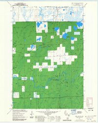
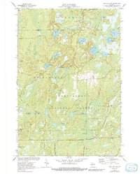
Editions of this 1971 Pike Lake NW Map
3 editions found
Other maps of this area

1940 · Mercer
USGS Topo · 1:48,000

1940 · Butternut
USGS Topo · 1:48,000

1941 · Park Falls
USGS Topo · 1:48,000

1941 · Pike Lake
USGS Topo · 1:48,000

1942 · Pike Lake
USGS Topo · 1:48,000

1943 · Park Falls
USGS Topo · 1:48,000

1945 · Mercer
USGS Topo · 1:48,000

1947 · Park Falls
USGS Topo · 1:48,000

1947 · Butternut
USGS Topo · 1:48,000

1947 · Mercer
USGS Topo · 1:48,000