
1967 Map of Pikes Peak
USGS Topo · Published 1970About this map
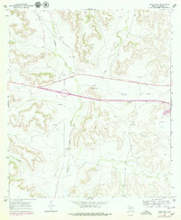
Pikes Peak rises above the West Texas landscape of Crockett County in the late 1960s, anchoring a territory defined by intermittent drainage and isolated ranching operations. The terrain is marked by the expansive Howard Draw and Eureka Draw, which carve through the high ground to shape the local hydrology. This period reveals a landscape transitioning from traditional ranching toward increased industrial and infrastructural development, evidenced by the numerous Drill Holes and several Gravel Pit sites scattered across the survey area.
Find a feature on this map
11 named features on this map. Tap any name to fly to it.
Don’t see what you’re looking for? This feature index may not catch every label — zoom into the map to look around manually.
Map Details
Editions of this 1967 Pikes Peak Map
2 editions found
Other maps of this area

1929 · Sheffield
USGS Topo · 1:125,000

1954 · Sonora
USGS Topo · 1:250,000

1958 · Sonora
USGS Topo · 1:250,000

1967 · Owens Creek SE
USGS Topo · 1:24,000

1967 · Burnt Canyon
USGS Topo · 1:24,000
1967 · Schneeman Draw SW
USGS Topo · 1:24,000

1967 · Hunt Ranch
USGS Topo · 1:24,000

1967 · Bachelor Hill
USGS Topo · 1:24,000
1967 · Schneeman Draw SE
USGS Topo · 1:24,000
1967 · Mitchell Canyon NE
USGS Topo · 1:24,000