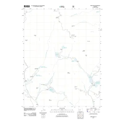
2011 Map of Pikes Peak
USGS Topo · Published 2011About this map
Pikes Peak anchors this high-altitude landscape, where the Summit House stands as a clear landmark reached by the winding Pikes Peak Toll Rd. The area is defined by a sophisticated network of water management and mining history, evidenced by subterranean features like the Strickler Tunnel and Saint John Tunnel. Below the peaks, the settlement of Gillett and the Tracie Group Mine point to the region's industrial past, while a complex system of reservoirs—including Cripple Creek Reservoir Number 3, Bison Reservoir, and Boehmer Reservoir—illustrates the critical infrastructure required to manage water in the Colorado mountains. Dramatic terrain features such as Devils Playground, The Crater, and the Bottomless Pit highlight the physical challenges of the summit, while lower elevations like Horsethief Park and Bull Park provide a contrast to the sheer granite faces of the Front Range.
Find a feature on this map
59 named features on this map. Tap any name to fly to it.
Don’t see what you’re looking for? This feature index may not catch every label — zoom into the map to look around manually.
Map Details
Editions of this 2011 Pikes Peak Map
This is the sole edition of this map. No revisions or reprints were ever made.
Other maps of this area

1893 · Colorado Springs
USGS Topo · 1:125,000

1894 · Pikes Peak
USGS Topo · 1:125,000

1901 · Pikes Peak
USGS Topo · 1:125,000

1901 · Pikes Peak
USGS Topo · 1:62,500

1909 · Colorado Springs
USGS Topo · 1:125,000

1942 · Colorado Springs
USGS Topo · 1:125,000

1948 · Mount Big Chief
USGS Topo · 1:24,000

1948 · Manitou Springs
USGS Topo · 1:24,000

1948 · Colorado Springs
USGS Topo · 1:62,500

1948 · Cascade
USGS Topo · 1:24,000