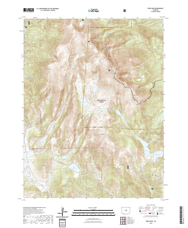
2022 Map of Pikes Peak
USGS Topo · Published 2022About this map
Pikes Peak anchors this high-altitude landscape where the complex water management systems of Teller and El Paso counties converge. The terrain is defined by a massive network of alpine catchments and reservoirs, including Bison Reservoir, McReynolds Reservoir, and Mason Reservoir, all linked by historical infrastructure like the Strickler Tunnel. These water bodies sit within the protected expanse of the Pike National Forest, where steep ridgelines descend from summits like Sachett Mtn and Sentinel Point into deep drainages such as Putney Gulch and Fourmile Cr.
Find a feature on this map
67 named features on this map. Tap any name to fly to it.
Don’t see what you’re looking for? This feature index may not catch every label — zoom into the map to look around manually.
Map Details
Editions of this 2022 Pikes Peak Map
This is the sole edition of this map. No revisions or reprints were ever made.
Other maps of this area

1893 · Colorado Springs
USGS Topo · 1:125,000

1894 · Pikes Peak
USGS Topo · 1:125,000

1901 · Pikes Peak
USGS Topo · 1:125,000

1901 · Pikes Peak
USGS Topo · 1:62,500

1909 · Colorado Springs
USGS Topo · 1:125,000

1942 · Colorado Springs
USGS Topo · 1:125,000

1948 · Mount Big Chief
USGS Topo · 1:24,000

1948 · Manitou Springs
USGS Topo · 1:24,000

1948 · Colorado Springs
USGS Topo · 1:62,500

1948 · Cascade
USGS Topo · 1:24,000