
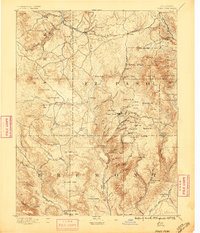
1894 Map of Pikes Peak
USGS Topo · Published 1894About this map
Cripple Creek and its surrounding mining camps define the core of this late nineteenth-century survey, appearing at the height of the region's gold rush. The map meticulously documents the network of gulches and hills that drove the local economy, including Poverty Gulch, Arequa Gulch, and Gassy Gulch, alongside a Stamp Mill that processed the ore. This landscape was fundamentally shaped by the Colorado Midland Railroad, which winds through the northern peaks and provides a vital link for settlements like Florissant and Divide.
Find a feature on this map
89 named features on this map. Tap any name to fly to it.
Don’t see what you’re looking for? This feature index may not catch every label — zoom into the map to look around manually.
Map Details
Editions of this 1894 Pikes Peak Map
2 editions found
Other maps of this area

1889 · Canon City
USGS Topo · 1:125,000

1891 · Pueblo
USGS Topo · 1:125,000

1892 · Canon City
USGS Topo · 1:125,000

1893 · Platte Canyon
USGS Topo · 1:125,000

1893 · Colorado Springs
USGS Topo · 1:125,000

1894 · Castle Rock
USGS Topo · 1:125,000

1894 · Pueblo
USGS Topo · 1:125,000

1896 · Pueblo
USGS Topo · 1:125,000

1897 · Pueblo
USGS Topo · 1:125,000

1901 · Pikes Peak
USGS Topo · 1:125,000