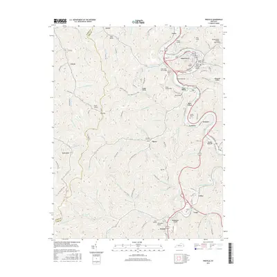
2016 Map of Pikeville
USGS Topo · Published 2016About this map
The Louisa Fork river winds through a landscape of deep hollows and narrow ridges in this 2016 survey of the Kentucky mountains. Pikeville serves as the regional hub, where the river's bend creates distinct topographic features like Narrows Bottom and Orchard Bottom. The terrain is marked by family-named landmarks and historical sites such as Cider Poor Farm Ridge and Peach Orchard Mtn. Several bridges, including the Middle Bridge and Upper Bridge, connect the town to surrounding settlements like Pauley and Mayo Village.
Find a feature on this map
131 named features on this map. Tap any name to fly to it.
Don’t see what you’re looking for? This feature index may not catch every label — zoom into the map to look around manually.
Map Details
Editions of this 2016 Pikeville Map
This is the sole edition of this map. No revisions or reprints were ever made.
Other maps of this area

1886 · Prestonsburg
USGS Topo · 1:125,000

1886 · Grundy
USGS Topo · 1:125,000

1887 · Warfield
USGS Topo · 1:125,000

1890 · Whitesburg
USGS Topo · 1:125,000

1890 · Grundy
USGS Topo · 1:125,000

1891 · Warfield
USGS Topo · 1:125,000

1892 · Grundy
USGS Topo · 1:125,000

1892 · Whitesburg
USGS Topo · 1:125,000

1892 · Prestonsburg
USGS Topo · 1:125,000

1914 · Laynesville
USGS Topo · 1:48,000