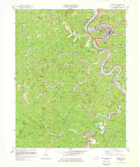
1978 Map of Pikeville
USGS Topo · Published 1979About this map
Pikeville serves as the focal point of this late-1970s study, where the Levisa Fork carves a sharp oxbow around the town's growing infrastructure. The landscape is defined by the heavy footprint of the regional coal industry, evidenced by numerous strip mines and local workings scattered across the high ridges of Duty Knob and Big Hill. Connectivity in the valley is managed by the C & O railroad, which follows the riverbank past industrial sites like Titan Siding.
Find a feature on this map
43 named features on this map. Tap any name to fly to it.
Don’t see what you’re looking for? This feature index may not catch every label — zoom into the map to look around manually.
Map Details
Editions of this 1978 Pikeville Map
This is the sole edition of this map. No revisions or reprints were ever made.
Other maps of this area

1886 · Prestonsburg
USGS Topo · 1:125,000

1886 · Grundy
USGS Topo · 1:125,000

1887 · Warfield
USGS Topo · 1:125,000

1890 · Whitesburg
USGS Topo · 1:125,000

1890 · Grundy
USGS Topo · 1:125,000

1891 · Warfield
USGS Topo · 1:125,000

1892 · Grundy
USGS Topo · 1:125,000

1892 · Whitesburg
USGS Topo · 1:125,000

1892 · Prestonsburg
USGS Topo · 1:125,000

1914 · Laynesville
USGS Topo · 1:48,000