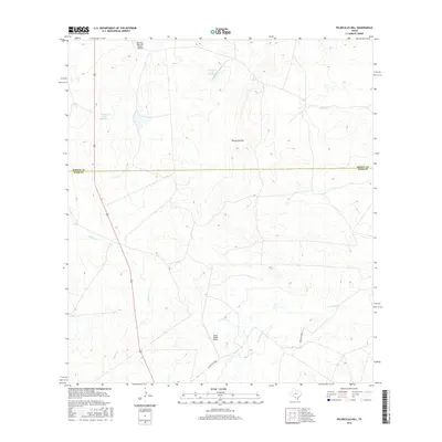
2016 Map of Piloncillo Hill
USGS Topo · Published 2016About this map
Piloncillo Hill rises as the central landmark in this portion of South Texas, marking a landscape defined by ranching operations and seasonal drainage systems. The terrain is bisected by the Dimmit Co Webb Co line, with the northern portion occupied by several reservoirs including Harrison Lake Number 2 and Harrison Lake Number 3. The reliance on aviation for regional connectivity is evident through specialized facilities like the Harrison Piloncillo Ranch Airport and the Strait Ranch Airport. A network of intermittent streams, including Canyon Cr, Pelon Ciz Cr, and Las Raices Cr, carve through the brush country, illustrating the hydraulic patterns of this arid environment. Significant infrastructure is represented by the north-south transit of Highway 83 and the presence of Ranch Rd 6238b, which provide the primary access to these large ranch holdings.
Find a feature on this map
11 named features on this map. Tap any name to fly to it.
Don’t see what you’re looking for? This feature index may not catch every label — zoom into the map to look around manually.
Map Details
Editions of this 2016 Piloncillo Hill Map
This is the sole edition of this map. No revisions or reprints were ever made.
Other maps of this area

1927 · Bart
USGS Topo · 1:62,500

1929 · Cotulla
USGS Topo · 1:125,000

1932 · Valley Wells
USGS Topo · 1:62,500

1940 · Velenzuela Creek
USGS Topo · 1:62,500

1940 · Catarina
USGS Topo · 1:62,500

1940 · Artesia Wells
USGS Topo · 1:62,500

1953 · Crystal City
USGS Topo · 1:250,000

1955 · Crystal City
USGS Topo · 1:250,000

1957 · Encinal
USGS Topo · 1:62,500

1961 · Crystal City
USGS Topo · 1:250,000