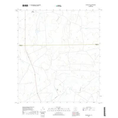
2019 Map of Piloncillo Hill
USGS Topo · Published 2019About this map
The Dimmit County and Webb County boundary line bisects this South Texas landscape, defined by expansive ranch lands and remote aviation infrastructure. Private air access serves the region through the Harrison Piloncillo Ranch Airport in the north and the Strait Ranch Airport further south. The terrain is carved by a network of seasonal watercourses, including Canyon Creek, Las Raices Creek, and Pelon Ciz Creek, which illustrate the natural drainage patterns of this arid brush country. Transport is anchored by the north-south corridor of Route 83, while Ranch Rd 62388 provides more localized access to the interior ranch estates and creek crossings. The sparse distribution of man-made features reflects a modern era of large-scale land management in the Texas borderlands.
Find a feature on this map
8 named features on this map. Tap any name to fly to it.
Don’t see what you’re looking for? This feature index may not catch every label — zoom into the map to look around manually.
Map Details
Editions of this 2019 Piloncillo Hill Map
This is the sole edition of this map. No revisions or reprints were ever made.
Other maps of this area

1927 · Bart
USGS Topo · 1:62,500

1929 · Cotulla
USGS Topo · 1:125,000

1932 · Valley Wells
USGS Topo · 1:62,500

1940 · Velenzuela Creek
USGS Topo · 1:62,500

1940 · Catarina
USGS Topo · 1:62,500

1940 · Artesia Wells
USGS Topo · 1:62,500

1953 · Crystal City
USGS Topo · 1:250,000

1955 · Crystal City
USGS Topo · 1:250,000

1957 · Encinal
USGS Topo · 1:62,500

1961 · Crystal City
USGS Topo · 1:250,000