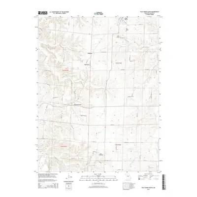
2015 Map of Pilot Grove South
USGS Topo · Published 2015About this map
Pilot Grove serves as the northern anchor of this landscape, where the Katy Trl follows the historic rail corridor south toward Pleasant Green. The terrain is defined by a dense network of waterways, including Skull Cr, Chouteau Cr, and the winding Lamine River in the southwest. Small settlements like Harriston and Hoffman are positioned along the local road system, which includes the well-traveled Georgetown Dr.
Find a feature on this map
64 named features on this map. Tap any name to fly to it.
Don’t see what you’re looking for? This feature index may not catch every label — zoom into the map to look around manually.
Map Details
Editions of this 2015 Pilot Grove South Map
This is the sole edition of this map. No revisions or reprints were ever made.
Other maps of this area

1887 · Sedalia
USGS Topo · 1:125,000

1888 · Boonville
USGS Topo · 1:125,000

1894 · Sedalia
USGS Topo · 1:125,000

1947 · Jefferson City
USGS Topo · 1:250,000

1952 · Tipton
USGS Topo · 1:24,000

1953 · Billingsville
USGS Topo · 1:24,000

1953 · Pilot Grove North
USGS Topo · 1:24,000

1953 · Pilot Grove South
USGS Topo · 1:24,000
1953 · Bunceton
USGS Topo · 1:24,000
1953 · Otterville East
USGS Topo · 1:24,000