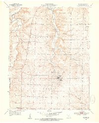
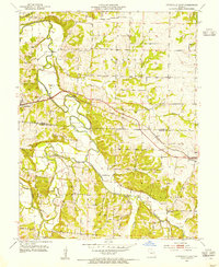
1953 Map of Bunceton
USGS Topo · Published 1954About this map
Bunceton stands as the primary hub in this mid-century survey of central Cooper County, Missouri. The landscape is defined by the winding course of the Petite Saline Cr and the prominent Clark Fork valley, where agricultural life is punctuated by smaller hamlets like Speed and Bellair. The transition of rural education is visible here, with both the Lone Elm Sch and sites of former community schools such as the Independence Sch (Abandoned) and Bethlehem Sch (Abandoned) documented. Local genealogy is well-served by the inclusion of several burial sites, including the Masonic Cem, Concord Cem, and Briscoe Cem. The terrain also reflects industrial activity of the period, notably a Quarry located north of Bellair and the various branches like Stephens Branch that drain the central townships of Palestine and Kelly.
Find a feature on this map
20 named features on this map. Tap any name to fly to it.
Don’t see what you’re looking for? This feature index may not catch every label — zoom into the map to look around manually.
Map Details
Editions of this 1953 Bunceton Map
3 editions found
Other maps of this area

1888 · Boonville
USGS Topo · 1:125,000

1947 · Jefferson City
USGS Topo · 1:250,000

1952 · Boonville
USGS Topo · 1:24,000

1952 · Tipton
USGS Topo · 1:24,000
1952 · Clarksburg
USGS Topo · 1:24,000

1952 · Lone Elm
USGS Topo · 1:24,000

1953 · Billingsville
USGS Topo · 1:24,000

1953 · Pilot Grove North
USGS Topo · 1:24,000

1953 · Pilot Grove South
USGS Topo · 1:24,000
1953 · Otterville East
USGS Topo · 1:24,000