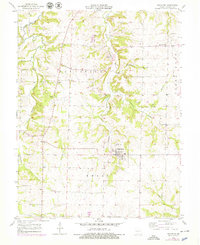
1953 Map of Bunceton
USGS Topo · Published 1979About this map
Bunceton sits as a central hub in this mid-century Cooper County survey, surrounded by the townships of Palestine, Clark, and Kelly. The landscape is defined by the winding course of the Petite Saline Cr and its many tributaries, including Stephens Branch and Coalsbank Branch. This mapping reflects a rural Missouri community where local life centered around small settlements like Speed and Bellair. A notable Quarry near Bellair indicates the local industry of the era, while the distribution of the Masonic Cem, Concord Cem, and Briscoe Cem provides critical points for genealogical research. The presence of the Lone Elm Sch in the northeastern corner of the map marks one of the surviving rural education sites in an area otherwise characterized by dispersed family farms and wooded creek bottoms.
Find a feature on this map
18 named features on this map. Tap any name to fly to it.
Don’t see what you’re looking for? This feature index may not catch every label — zoom into the map to look around manually.
Map Details
Editions of this 1953 Bunceton Map
3 editions found
Other maps of this area

1888 · Boonville
USGS Topo · 1:125,000

1947 · Jefferson City
USGS Topo · 1:250,000

1952 · Boonville
USGS Topo · 1:24,000

1952 · Tipton
USGS Topo · 1:24,000
1952 · Clarksburg
USGS Topo · 1:24,000

1952 · Lone Elm
USGS Topo · 1:24,000

1953 · Billingsville
USGS Topo · 1:24,000

1953 · Pilot Grove North
USGS Topo · 1:24,000

1953 · Pilot Grove South
USGS Topo · 1:24,000
1953 · Bunceton
USGS Topo · 1:24,000