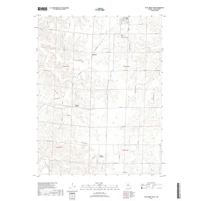
2017 Map of Pilot Grove South
USGS Topo · Published 2017About this map
Pilot Grove anchors the northern edge of this Cooper County landscape, where the terrain begins to ripple with the drainage systems of the Lamine R and Petite Saline Cr. The map documents a predominantly rural and agricultural layout in 2017, marked by small historic clusters like Pleasant Green and New Lebanon. These settlements are connected by a network of named country roads that often reflect local heritage, such as Harriston Station Rd and Mount Nebo Church Ln. Evidence of the area's long-standing community life is visible in the placement of Saint Joseph Cem and Mount Vernon Cem. The geography is defined by numerous smaller waterways, including Honey Cr and Baslee Br, which carve out the gently undulating land between the townships. This survey serves as a modern record of persistent rural patterns, showing how contemporary infrastructure like State HWY N overlays much older paths of movement and habitation.
Find a feature on this map
60 named features on this map. Tap any name to fly to it.
Don’t see what you’re looking for? This feature index may not catch every label — zoom into the map to look around manually.
Map Details
Editions of this 2017 Pilot Grove South Map
This is the sole edition of this map. No revisions or reprints were ever made.
Other maps of this area

1887 · Sedalia
USGS Topo · 1:125,000

1888 · Boonville
USGS Topo · 1:125,000

1894 · Sedalia
USGS Topo · 1:125,000

1947 · Jefferson City
USGS Topo · 1:250,000

1952 · Tipton
USGS Topo · 1:24,000

1953 · Billingsville
USGS Topo · 1:24,000

1953 · Pilot Grove North
USGS Topo · 1:24,000

1953 · Pilot Grove South
USGS Topo · 1:24,000
1953 · Bunceton
USGS Topo · 1:24,000
1953 · Otterville East
USGS Topo · 1:24,000