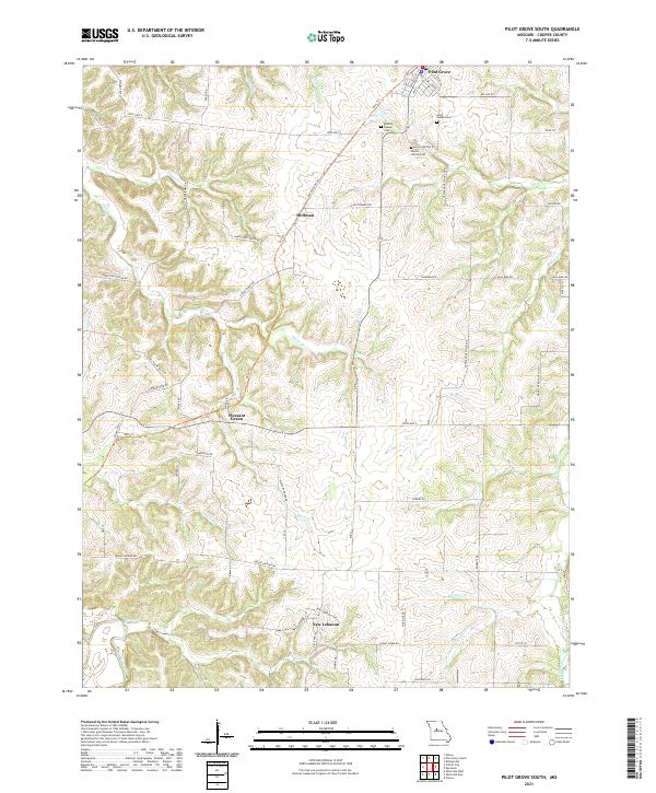
2021 Map of Pilot Grove South
USGS Topo · Published 2021About this map
Pilot Grove sits at the northern edge of this Cooper County landscape, where the local terrain is defined by the winding paths of Chouteau Cr and the W Fork Petite Saline Cr. The area maintains a rural character centered around small communities such as Pleasant Green, New Lebanon, and Hoffman. For those researching local heritage, the map identifies several significant locations including Saint Joseph Cem, Mount Vernon Cem, and the Wesley Chapel Cem. The transition from historical rail use to modern recreation is evident in the Katy Trl, which traverses the county's rolling hills. Local infrastructure, from Crossroads School Dr to Mount Nebo Church Ln, reflects a landscape deeply rooted in family farmsteads and small-town Missouri history.
Find a feature on this map
63 named features on this map. Tap any name to fly to it.
Don’t see what you’re looking for? This feature index may not catch every label — zoom into the map to look around manually.
Map Details
Editions of this 2021 Pilot Grove South Map
This is the sole edition of this map. No revisions or reprints were ever made.
Other maps of this area

1887 · Sedalia
USGS Topo · 1:125,000

1888 · Boonville
USGS Topo · 1:125,000

1894 · Sedalia
USGS Topo · 1:125,000

1947 · Jefferson City
USGS Topo · 1:250,000

1952 · Tipton
USGS Topo · 1:24,000

1953 · Billingsville
USGS Topo · 1:24,000

1953 · Pilot Grove North
USGS Topo · 1:24,000

1953 · Pilot Grove South
USGS Topo · 1:24,000
1953 · Bunceton
USGS Topo · 1:24,000
1953 · Otterville East
USGS Topo · 1:24,000