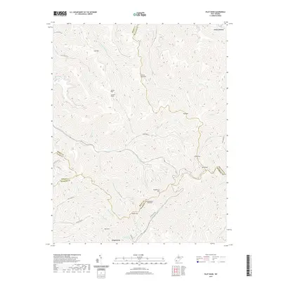
2019 Map of Pilot Knob
USGS Topo · Published 2019About this map
Kopperston and the surrounding high ridges of the Alleghenies define this landscape at the intersection of Boone, Raleigh, Logan, and Wyoming counties. The terrain is a complex network of steep peaks and narrow hollows, where life follows the paths of waterways like Pond Fork and Clear Fork. Named for family legacies and local landmarks, the topography includes significant elevations such as Cherry Pond Mtn and Guyandotte Mountain, with essential transit points found at Indian Gap and Walnut Gap.
Find a feature on this map
52 named features on this map. Tap any name to fly to it.
Don’t see what you’re looking for? This feature index may not catch every label — zoom into the map to look around manually.
Map Details
Editions of this 2019 Pilot Knob Map
This is the sole edition of this map. No revisions or reprints were ever made.
Other maps of this area

1891 · Oceana
USGS Topo · 1:125,000

1891 · Raleigh
USGS Topo · 1:125,000

1893 · Oceana
USGS Topo · 1:125,000

1897 · Raleigh
USGS Topo · 1:125,000

1898 · Oceana
USGS Topo · 1:125,000

1902 · Raleigh
USGS Topo · 1:125,000

1910 · Pineville
USGS Topo · 1:48,000

1910 · Bald Knob
USGS Topo · 1:48,000

1911 · Marshes
USGS Topo · 1:48,000

1912 · Mullens
USGS Topo · 1:62,500