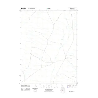
2012 Map of Pilot Peak SW
USGS Topo · Published 2012About this map
Pilot Creek and its seasonal tributaries define the landscape of this high-desert region in eastern Elko County. The area is characterized by vast drainage systems, including Debbs Creek and Buckhorn Creek, which flow toward the basin floor from the surrounding heights. Evidence of human adaptation to this arid environment appears at the Stockland Reservoir, a critical water management feature for the region's ranching operations. The Pilot Mountain Ranch serves as a primary point of settlement, connected to the wider valley by the utilitarian path of Pilot Rd. A curious grid remnant, indicated by 1st St, suggests a planned but sparse layout in an otherwise open range. This 2012 survey illustrates the modern configuration of traditional Nevada ranching lands, where topography and water access dictate the placement of roads and homesteads.
Find a feature on this map
7 named features on this map. Tap any name to fly to it.
Don’t see what you’re looking for? This feature index may not catch every label — zoom into the map to look around manually.
Map Details
Editions of this 2012 Pilot Peak SW Map
This is the sole edition of this map. No revisions or reprints were ever made.
Other maps of this area

1955 · Wells
USGS Topo · 1:250,000

1955 · Elko
USGS Topo · 1:250,000

1958 · Wells
USGS Topo · 1:250,000

1958 · Elko
USGS Topo · 1:250,000

1961 · Wells
USGS Topo · 1:250,000

1962 · Elko
USGS Topo · 1:250,000

1965 · Elko
USGS Topo · 1:250,000

1967 · Pilot Peak
USGS Topo · 1:24,000

1967 · Loray
USGS Topo · 1:24,000

1967 · Patterson Pass
USGS Topo · 1:24,000