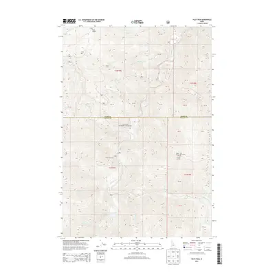
2013 Map of Pilot Peak
USGS Topo · Published 2013About this map
The South Fork Salmon River carves through the center of this high-elevation landscape, defining the border between Idaho and Valley Counties. Located within the Payette National Forest, this 2013 survey illustrates a wilderness defined by its drainage systems and vertical relief. Prominent peaks such as China Mtn and Pilot Peak provide the primary navigational landmarks for this region, with the Pilot Peak Lookout positioned as a vital observation point. The map reveals the infrastructure of forest recreation and management through features like the Shiefer Campground and Hettinger Trailhead. Notable for its intricate network of tributaries, including Middle Fork Elk Cr and Johnson Cr, the terrain remains largely untamed by modern development, appearing as a preserved piece of the Idaho backcountry.
Find a feature on this map
36 named features on this map. Tap any name to fly to it.
Don’t see what you’re looking for? This feature index may not catch every label — zoom into the map to look around manually.
Map Details
Editions of this 2013 Pilot Peak Map
This is the sole edition of this map. No revisions or reprints were ever made.
Other maps of this area

1937 · Big Creek
USGS Topo · 1:48,000

1942 · Big Creek
USGS Topo · 1:62,500

1956 · Warren
USGS Topo · 1:62,500

1956 · Elk City
USGS Topo · 1:250,000

1960 · Elk City
USGS Topo · 1:250,000

1969 · Profile Gap
USGS Topo · 1:24,000

1969 · Pony Meadows
USGS Topo · 1:24,000

1969 · Parks Peak
USGS Topo · 1:24,000

1969 · Wolf Fang Peak
USGS Topo · 1:24,000

1969 · Williams Peak
USGS Topo · 1:24,000