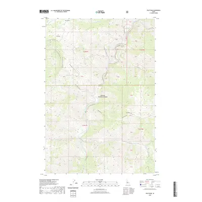
2020 Map of Pilot Peak
USGS Topo · Published 2020About this map
Pilot Peak and Rattlesnake Peak dominate this high-altitude landscape within the Payette National Forest, where the terrain is defined by the deep drainage of the South Fork Salmon River. This 2020 survey documents a backcountry network of forest roads and trails, including the Elk Summit Rd and the S Fork Guard Station Rd, which provide access to remote peaks and saddles. The area's complex hydrology is meticulously recorded, showing numerous tributaries such as Mayflower Cr, Big Flat Cr, and W Fork Elk Creek. The boundary between Idaho and Valley Counties bisects the region, marking a high divide between these rugged jurisdictions. Landforms like Buck Saddle and China Mtn suggest a landscape used for navigation and fire lookout points, while features such as Skunk Spring indicate isolated water sources critical for high-country travel.
Find a feature on this map
56 named features on this map. Tap any name to fly to it.
Don’t see what you’re looking for? This feature index may not catch every label — zoom into the map to look around manually.
Map Details
Editions of this 2020 Pilot Peak Map
This is the sole edition of this map. No revisions or reprints were ever made.
Other maps of this area

1937 · Big Creek
USGS Topo · 1:48,000

1942 · Big Creek
USGS Topo · 1:62,500

1956 · Warren
USGS Topo · 1:62,500

1956 · Elk City
USGS Topo · 1:250,000

1960 · Elk City
USGS Topo · 1:250,000

1969 · Profile Gap
USGS Topo · 1:24,000

1969 · Pony Meadows
USGS Topo · 1:24,000

1969 · Parks Peak
USGS Topo · 1:24,000

1969 · Wolf Fang Peak
USGS Topo · 1:24,000

1969 · Williams Peak
USGS Topo · 1:24,000