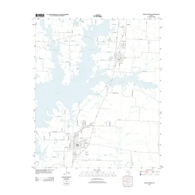
2013 Map of Pilot Point
USGS Topo · Published 2013About this map
The town of Pilot Point and the city of Tioga anchor this 2013 survey of north-central Texas, where the landscape is defined by the expansive waters of Lake Ray Roberts. The map details the intricate fingers and coves of the reservoir as they reach into the surrounding prairie, illustrating how the damming of Pecan Cr fundamentally reshaped the local geography. Significant for genealogical research, the sheet identifies the locations of Tioga Cem and Skinner Cem, alongside smaller private water bodies like Robert W Henzler Lake and B and L Ranch Lake. The transition from rural ranching to modern development is visible in the network of legacy routes such as Cattle Trl and McDaniel Rd juxtaposed against newer residential infrastructure and the presence of Airport Rd.
Find a feature on this map
88 named features on this map. Tap any name to fly to it.
Don’t see what you’re looking for? This feature index may not catch every label — zoom into the map to look around manually.
Map Details
Editions of this 2013 Pilot Point Map
This is the sole edition of this map. No revisions or reprints were ever made.
Other maps of this area

1901 · Denison
USGS Topo · 1:125,000

1902 · Gainesville
USGS Topo · 1:125,000

1943 · Gainesville
USGS Topo · 1:125,000

1954 · Sherman
USGS Topo · 1:250,000

1958 · Whitesboro
USGS Topo · 1:62,500

1958 · Sherman
USGS Topo · 1:250,000

1960 · Green Valley
USGS Topo · 1:24,000

1960 · Celina
USGS Topo · 1:24,000

1960 · Aubrey
USGS Topo · 1:24,000

1960 · Woodbine
USGS Topo · 1:24,000