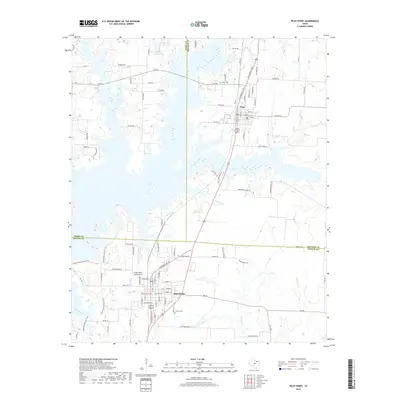
2019 Map of Pilot Point
USGS Topo · Published 2019About this map
Pilot Point serves as a primary hub in this North Texas landscape, where the boundaries of Denton, Cooke, and Grayson counties intersect near the northern reaches of Lake Ray Roberts. The town's grid is detailed down to streets like W Main St and E Liberty St, with the Skinner Cem situated on its southern edge. To the north, the settlement of Tioga is centered around the intersection of Texas St and the Ray Roberts Pkwy, neighboring the Tioga Cem. The terrain is defined by a dendritic network of waterways, including Pecan Cr and Pierce Spring Br, which feed into the area's larger reservoir system. Rural life is evidenced by family-named ranch lakes like Band L Ranch Lake and the persistence of historic routes such as the Cattle Trl, reflecting the region's enduring agricultural and equestrian character.
Find a feature on this map
96 named features on this map. Tap any name to fly to it.
Don’t see what you’re looking for? This feature index may not catch every label — zoom into the map to look around manually.
Map Details
Editions of this 2019 Pilot Point Map
This is the sole edition of this map. No revisions or reprints were ever made.
Other maps of this area

1901 · Denison
USGS Topo · 1:125,000

1902 · Gainesville
USGS Topo · 1:125,000

1943 · Gainesville
USGS Topo · 1:125,000

1954 · Sherman
USGS Topo · 1:250,000

1958 · Whitesboro
USGS Topo · 1:62,500

1958 · Sherman
USGS Topo · 1:250,000

1960 · Green Valley
USGS Topo · 1:24,000

1960 · Celina
USGS Topo · 1:24,000

1960 · Aubrey
USGS Topo · 1:24,000

1960 · Woodbine
USGS Topo · 1:24,000