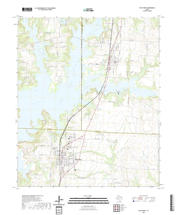
2022 Map of Pilot Point
USGS Topo · Published 2022About this map
Pilot Point and Tioga serve as the primary hubs in this modern survey of the North Texas plains, situated near the meeting point of Denton, Grayson, and Cooke counties. The landscape is defined by the expansive waters of Isle du Bois Creek and its various tributaries like Buck Creek and Pecan Cr, which feed into the northern reaches of local reservoirs. This area maintains a distinct rural character, evidenced by the numerous local burial grounds that mark the heritage of the region, including Saint Thomas Cem and the Skinner Cem.
Find a feature on this map
108 named features on this map. Tap any name to fly to it.
Don’t see what you’re looking for? This feature index may not catch every label — zoom into the map to look around manually.
Map Details
Editions of this 2022 Pilot Point Map
This is the sole edition of this map. No revisions or reprints were ever made.
Other maps of this area

1901 · Denison
USGS Topo · 1:125,000

1902 · Gainesville
USGS Topo · 1:125,000

1943 · Gainesville
USGS Topo · 1:125,000

1954 · Sherman
USGS Topo · 1:250,000

1958 · Whitesboro
USGS Topo · 1:62,500

1958 · Sherman
USGS Topo · 1:250,000

1960 · Green Valley
USGS Topo · 1:24,000

1960 · Celina
USGS Topo · 1:24,000

1960 · Aubrey
USGS Topo · 1:24,000

1960 · Woodbine
USGS Topo · 1:24,000