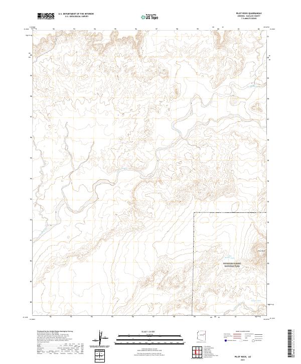
2021 Map of Pilot Rock
USGS Topo · Published 2021About this map
Petrified Forest National Park covers the southeastern portion of this landscape, where the high desert terrain is defined by complex drainage systems and isolated water sources. The prominent landmark of Pilot Rock stands near the eastern edge, overlooking a network of seasonal watercourses including the wide path of Leroux Wash and the smaller Digger Wash. This high-elevation environment is dotted with vital stock tanks like Two-Mile Tank, Rabbit Tank, and Little Rabbit Tank, which supported ranching efforts in this arid section of Navajo County. The map details the Township and Range lines that surveyed this remote territory, illustrating the intersection of federal protected lands and the open range before the most recent modern developments.
Find a feature on this map
11 named features on this map. Tap any name to fly to it.
Don’t see what you’re looking for? This feature index may not catch every label — zoom into the map to look around manually.
Map Details
Editions of this 2021 Pilot Rock Map
This is the sole edition of this map. No revisions or reprints were ever made.
Other maps of this area

1883 · Tusayan
USGS Topo · 1:250,000

1886 · Tusayan
USGS Topo · 1:250,000

1886 · Fort Defiance
USGS Topo · 1:250,000

1892 · Fort Defiance
USGS Topo · 1:250,000

1947 · Flagstaff
USGS Topo · 1:250,000

1954 · Flagstaff
USGS Topo · 1:250,000

1954 · Gallup
USGS Topo · 1:250,000

1958 · Gallup
USGS Topo · 1:250,000

1958 · Flagstaff
USGS Topo · 1:250,000

1959 · Gallup
USGS Topo · 1:250,000