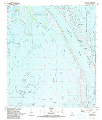
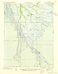
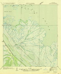
1993 Map of Pilottown
USGS Topo · Published 1993About this map
The Mississippi River creates a complex hydrologic network as it reaches the Head of Passes, where the river splits into major outlets like Southwest Pass and Main Pass. This remote delta environment is dominated by the Pilottown settlement, a vital outpost for maritime navigation. The area's dual character is defined by heavy conservation efforts within the Delta National Wildlife Refuge and industrial activity at the West Bay Oil and Gas Field. Man-made modifications to the shifting wetlands are evident in the numerous platforms, a Radio Tower, and a series of canals and levees. Local names like Andres Pond, Mary Bowers Pond, and Bob Taylors Pond hint at the individuals who worked and lived in this fluid landscape of Cubits Gap and Zinzin Bay.
Find a feature on this map
53 named features on this map. Tap any name to fly to it.
Don’t see what you’re looking for? This feature index may not catch every label — zoom into the map to look around manually.
Map Details
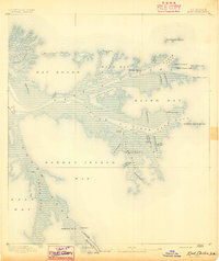
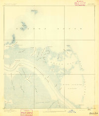
Editions of this 1993 Pilottown Map
2 editions found

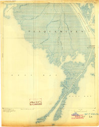
Other maps of this area
1893 · East Delta
USGS Topo · 1:62,500
1893 · Forts
USGS Topo · 1:62,500
1893 · West Delta
USGS Topo · 1:62,500
1935 · South Pass
USGS Topo · 1:31,680

1946 · Pass Du Bois
USGS Topo · 1:31,680

1946 · Pass Tante Phine
USGS Topo · 1:31,680

1947 · Pass A Loutre West
USGS Topo · 1:31,680
1947 · Venice
USGS Topo · 1:31,680

1947 · Fort St. Philip
USGS Topo · 1:31,680

1947 · Southwest Pass
USGS Topo · 1:31,680