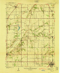
1940 Map of Pimento
USGS Topo · Published 1940About this map
Farmersburg and Pimento anchor this 1938 survey of southern Vigo County, where the transition from flat prairie to the dissected drainages of the Wabash valley is clearly visible. The landscape is defined by the course of Honey Creek and the meandering Prairie Creek, which feed into wetlands such as Goose Pond and Hayworth Slough. Significant early transportation routes are captured here, including the Dixie Highway running north-south through Youngstown and the historic Harrison Trail cutting across the northwestern corner.
Find a feature on this map
28 named features on this map. Tap any name to fly to it.
Don’t see what you’re looking for? This feature index may not catch every label — zoom into the map to look around manually.
Map Details
Editions of this 1940 Pimento Map
2 editions found
Other maps of this area

1932 · Marshall
USGS Topo · 1:62,500

1937 · Marshall
USGS Topo · 1:62,500

1940 · Lewis
USGS Topo · 1:24,000

1940 · Pimento
USGS Topo · 1:24,000

1941 · Seelyville
USGS Topo · 1:24,000

1941 · Terre Haute
USGS Topo · 1:24,000

1942 · Fairbanks
USGS Topo · 1:24,000

1942 · Shelburn
USGS Topo · 1:24,000

1942 · Hutton
USGS Topo · 1:24,000

1942 · Dennison
USGS Topo · 1:24,000