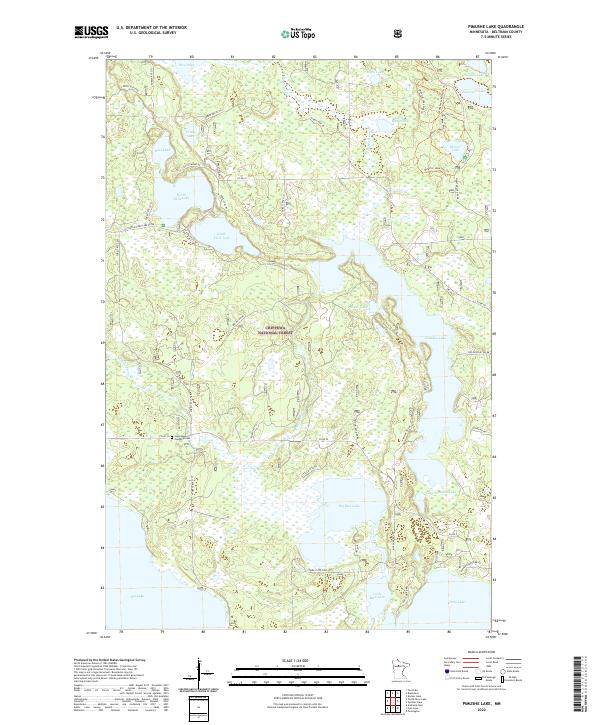
2022 Map of Pimushe Lake
USGS Topo · Published 2022About this map
Chippewa National Forest surrounds this water-dense landscape in Beltrami County, defined by a complex network of glacial lakes and the winding Turtle River. The central focus is the sprawling Pimushe Lake, which is connected to nearby Little Pimushe Lake and Big Rice Lake through a series of channels and wetlands. This 2022 survey captures the contemporary layout of forest access roads, such as Co Rd 20 and Scenic Hwy NE, which navigate the fragmented terrain between major bodies of water like North Twin Lake and South Twin Lake. Evidence of local heritage and the rural community is found at the Sugar Bush Township Cem located near the intersection of several forest routes. The map also delineates recreational paths including the Webster Lake Walking Trl, illustrating the area's modern land use as a hub for forestry and seasonal outdoor activity.
Find a feature on this map
57 named features on this map. Tap any name to fly to it.
Don’t see what you’re looking for? This feature index may not catch every label — zoom into the map to look around manually.
Map Details
Editions of this 2022 Pimushe Lake Map
This is the sole edition of this map. No revisions or reprints were ever made.
Other maps of this area

1919 · Rosy
USGS Topo · 1:62,500

1954 · Bemidji
USGS Topo · 1:250,000

1957 · Bemidji
USGS Topo · 1:250,000

1958 · Bemidji
USGS Topo · 1:250,000

1971 · Gimmer Lake
USGS Topo · 1:24,000

1971 · Decker Lake
USGS Topo · 1:24,000

1971 · Pennington
USGS Topo · 1:24,000
1972 · Blackduck
USGS Topo · 1:24,000

1972 · Turtle River Lake
USGS Topo · 1:24,000
1972 · Pimushe Lake
USGS Topo · 1:24,000