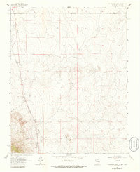
1963 Map of Pinabetoso Peaks
USGS Topo · Published 1986About this map
Pinabetoso Peaks dominates the southeastern quadrant of this terrain, where the high desert plateau of northern New Mexico meets the Colorado border. The landscape is defined by the remnants of transit and extraction, most notably the Old Railroad Grade that winds through the western portion of the sheet. This route, alongside various unnamed tracks and a Jeep Trail, suggests a period of transition where early industrial infrastructure began to fade into a more modern network of resource management. Evidence of local utility and industry appears in the form of a Gravel Pit and a scattered Well, marking the practical human presence in this high-altitude environment. Several administrative markers, including the Conejos Co Taos Co line and an Indefinite Boundary, intersect the topography, reflecting the complex jurisdictional history of the borderlands during the early 1960s.
Find a feature on this map
9 named features on this map. Tap any name to fly to it.
Don’t see what you’re looking for? This feature index may not catch every label — zoom into the map to look around manually.
Map Details
Editions of this 1963 Pinabetoso Peaks Map
2 editions found

Other maps of this area

1918 · Tusas
USGS Topo · 1:125,000

1922 · Conejos
USGS Topo · 1:125,000

1945 · Durango
USGS Topo · 1:250,000

1953 · Durango
USGS Topo · 1:250,000

1954 · Durango
USGS Topo · 1:250,000

1954 · Raton
USGS Topo · 1:250,000

1954 · Trinidad
USGS Topo · 1:250,000

1954 · Aztec
USGS Topo · 1:250,000

1955 · Trinidad
USGS Topo · 1:250,000

1958 · Raton
USGS Topo · 1:250,000