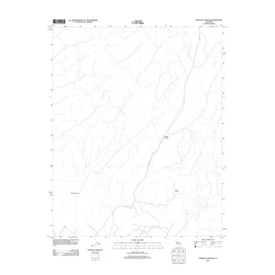
2012 Map of Pinalito Canyon
USGS Topo · Published 2012About this map
San Lorenzo Cr meanders through this portion of Monterey County, defining the drainage patterns of a landscape shaped by significant relief. In the early 21st century, the area remains dominated by prominent landforms such as Pinalito Canyon and Black Canyon, which illustrate the complex topography of the California Coast Ranges. The road network is sparse, centered on the transit corridors of Bitterwater Rd and King City Rd. These routes serve as the primary links through the valleys, including Becker Valley, connecting the isolated ranching or agricultural lands to the larger regional hubs. The map provides a clear look at the relationship between the seasonal watercourses and the steep canyon walls that dictate human movement and settlement patterns in this part of the state.
Find a feature on this map
6 named features on this map. Tap any name to fly to it.
Don’t see what you’re looking for? This feature index may not catch every label — zoom into the map to look around manually.
Map Details
Editions of this 2012 Pinalito Canyon Map
This is the sole edition of this map. No revisions or reprints were ever made.
Other maps of this area

1912 · Metz
USGS Topo · 1:31,680

1915 · Priest Valley
USGS Topo · 1:125,000

1919 · King City
USGS Topo · 1:62,500

1921 · Metz
USGS Topo · 1:62,500

1939 · King City
USGS Topo · 1:62,500

1940 · Metz
USGS Topo · 1:62,500

1941 · San Ardo
USGS Topo · 1:62,500

1943 · San Ardo
USGS Topo · 1:62,500

1943 · Hernandez Valley
USGS Topo · 1:62,500

1944 · Hernandez Valley
USGS Topo · 1:62,500