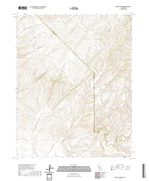
2021 Map of Pinalito Canyon
USGS Topo · Published 2021About this map
Monterey County and San Benito County meet along a jagged diagonal through this high-relief landscape, where deep drainages have carved an intricate system of canyons and ridges. The southern portion of the map is defined by the winding course of San Lorenzo Cr, which flows through a relatively open valley floor before the terrain rises sharply into the surrounding hills. This area serves as a significant drainage basin for numerous named canyons, including the expansive Llano Grande Canyon and Agua Grande Canyon to the west.
Find a feature on this map
21 named features on this map. Tap any name to fly to it.
Don’t see what you’re looking for? This feature index may not catch every label — zoom into the map to look around manually.
Map Details
Editions of this 2021 Pinalito Canyon Map
This is the sole edition of this map. No revisions or reprints were ever made.
Other maps of this area

1912 · Metz
USGS Topo · 1:31,680

1915 · Priest Valley
USGS Topo · 1:125,000

1919 · King City
USGS Topo · 1:62,500

1921 · Metz
USGS Topo · 1:62,500

1939 · King City
USGS Topo · 1:62,500

1940 · Metz
USGS Topo · 1:62,500

1941 · San Ardo
USGS Topo · 1:62,500

1943 · San Ardo
USGS Topo · 1:62,500

1943 · Hernandez Valley
USGS Topo · 1:62,500

1944 · Hernandez Valley
USGS Topo · 1:62,500