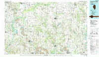
1985 Map of Pinckneyville
USGS Topo · Published 1988About this map
Belleville and Mascoutah anchor the northwest corner of this mid-1980s landscape, where the transition from industrial mining to managed conservation is clearly visible. The southern half of the map is heavily marked by extensive Strip Mine operations, particularly around Pyramid State Park and south of Marissa. This era of land use is balanced by large-scale conservation efforts along the river corridors, including the Kaskaskia River State Fish and Wildlife Area and the Washington County State Conservation Area.
Find a feature on this map
172 named features on this map. Tap any name to fly to it.
Don’t see what you’re looking for? This feature index may not catch every label — zoom into the map to look around manually.
Map Details
Editions of this 1985 Pinckneyville Map
2 editions found
Other maps of this area

1888 · St. Louis
USGS Topo · 1:62,500

1906 · Breese
USGS Topo · 1:62,500

1907 · Breese
USGS Topo · 1:62,500

1907 · Belleville
USGS Topo · 1:62,500

1907 · Weingarten
USGS Topo · 1:62,500

1909 · Weingarten
USGS Topo · 1:62,500

1909 · West Frankfort
USGS Topo · 1:62,500

1910 · Herrin
USGS Topo · 1:62,500

1910 · Carlyle
USGS Topo · 1:62,500

1910 · Murphysboro
USGS Topo · 1:62,500