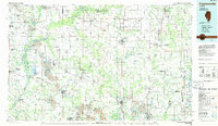
1985 Map of Pinckneyville
USGS Topo · Published 1985About this map
Kaskaskia River State Fish and Wildlife Area dominates the western portion of this 1980s landscape, illustrating a region defined by its complex hydrology and coal extraction. The map reveals a transition from the agricultural heartlands of Grande Cote Prairie to the industrial imprints of several Strip Mine operations scattered between Marissa and Pinckneyville. This period shows the enduring importance of the railroad network, featuring the Illinois Central Gulf and Missouri Pacific lines connecting established hubs like Belleville and Nashville.
Find a feature on this map
167 named features on this map. Tap any name to fly to it.
Don’t see what you’re looking for? This feature index may not catch every label — zoom into the map to look around manually.
Map Details
Editions of this 1985 Pinckneyville Map
2 editions found
Other maps of this area

1888 · St. Louis
USGS Topo · 1:62,500

1906 · Breese
USGS Topo · 1:62,500

1907 · Breese
USGS Topo · 1:62,500

1907 · Belleville
USGS Topo · 1:62,500

1907 · Weingarten
USGS Topo · 1:62,500

1909 · Weingarten
USGS Topo · 1:62,500

1909 · West Frankfort
USGS Topo · 1:62,500

1910 · Herrin
USGS Topo · 1:62,500

1910 · Carlyle
USGS Topo · 1:62,500

1910 · Murphysboro
USGS Topo · 1:62,500