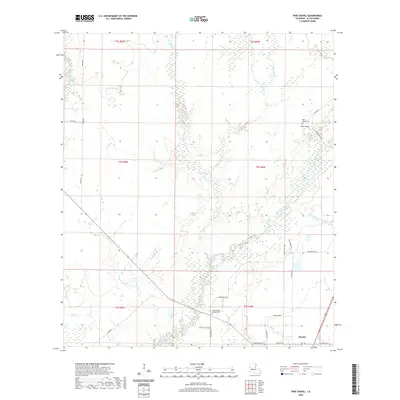
2020 Map of Pine Chapel
USGS Topo · Published 2020About this map
The Calcasieu River meanders through the heart of this Allen Parish landscape, defining a terrain of wetlands and complex water systems. Near the northern reach, the settlement of Pine Chapel is situated alongside its namesake Pine Chapel Cem, while the southern portion of the map includes the edge of Oberlin, the parish seat. The drainage patterns are intricate, with Mill Cr, Little Mill Cr, and Chinquapin Cr feeding into the main river channel. Local history is anchored by sites such as the Oaklin Springs Baptist Cem, located near the intersection of Parish Rd 19 and Veville Vizena RD. The map documents a network of rural routes, including Pistol Ridge Rd and S River Rd, which trace the higher ground between the frequent gullies and creek beds like Long Gully and Stines Cr.
Find a feature on this map
34 named features on this map. Tap any name to fly to it.
Don’t see what you’re looking for? This feature index may not catch every label — zoom into the map to look around manually.
Map Details
Editions of this 2020 Pine Chapel Map
This is the sole edition of this map. No revisions or reprints were ever made.
Other maps of this area

1935 · Mittie
USGS Topo · 1:31,680

1935 · Oakdale
USGS Topo · 1:31,680

1942 · Oakdale
USGS Topo · 1:62,500

1947 · Foley
USGS Topo · 1:31,680

1947 · Oberlin
USGS Topo · 1:31,680

1947 · Pine Chapel
USGS Topo · 1:31,680

1947 · Le Blanc
USGS Topo · 1:31,680

1947 · Elizabeth
USGS Topo · 1:31,680

1947 · Grant
USGS Topo · 1:31,680

1948 · Grant
USGS Topo · 1:24,000