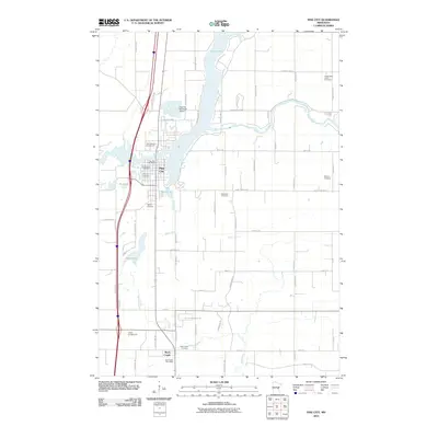
2010 Map of Pine City
USGS Topo · Published 2010About this map
Pine City and Rock Creek anchor this 2010 survey of Pine County, Minnesota, where the Snake River flows through Cross Lake before continuing its winding path eastward. The landscape is characterized by a dense network of local roads and highways, including County Hwy 9 and Military Rd, which connect scattered residential areas and agricultural lands.
Find a feature on this map
68 named features on this map. Tap any name to fly to it.
Don’t see what you’re looking for? This feature index may not catch every label — zoom into the map to look around manually.
Map Details
Editions of this 2010 Pine City Map
This is the sole edition of this map. No revisions or reprints were ever made.
Other maps of this area

1950 · Rush City
USGS Topo · 1:48,000

1953 · Stillwater
USGS Topo · 1:250,000

1955 · Rush City
USGS Topo · 1:62,500

1955 · Stillwater
USGS Topo · 1:250,000

1958 · Stillwater
USGS Topo · 1:250,000

1961 · Cambridge
USGS Topo · 1:62,500

1961 · Brook Park
USGS Topo · 1:62,500

1961 · Pine City
USGS Topo · 1:62,500

1965 · Stillwater
USGS Topo · 1:250,000

1975 · Stillwater
USGS Topo · 1:250,000
Featured Places
- Pine City, MN
- Rock Creek, MN
- Pine City Township, MN
- Pine Terrace Mobile Home Park, Pine City
- Pokegama Township, MN