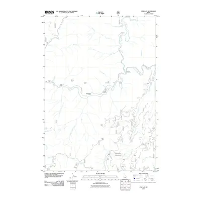
2011 Map of Pine Flat
USGS Topo · Published 2011About this map
Pine Flat Hot Springs sits along the South Fork Payette River, a central watercourse that dictates the geography of this Boise County region. The confluence of the Deadwood River and the Payette creates a corridor for travel and recreation, marked by sites like the Pine Flats Campground and Deadwood Campground. The landscape transitions from river flats such as Birch Flat and Pidgeon Flat into a series of steep drainages and ridges, including the prominent Burns Ridge and Beaver Creek Summit.
Find a feature on this map
47 named features on this map. Tap any name to fly to it.
Don’t see what you’re looking for? This feature index may not catch every label — zoom into the map to look around manually.
Map Details
Editions of this 2011 Pine Flat Map
This is the sole edition of this map. No revisions or reprints were ever made.
Other maps of this area

1894 · Idaho Basin
USGS Topo · 1:125,000

1909 · Garden Valley
USGS Topo · 1:125,000

1955 · Hailey
USGS Topo · 1:250,000

1957 · Pioneerville
USGS Topo · 1:24,000

1957 · Challis
USGS Topo · 1:250,000

1959 · Hailey
USGS Topo · 1:250,000

1959 · Garden Valley
USGS Topo · 1:62,500

1960 · Challis
USGS Topo · 1:250,000

1962 · Hailey
USGS Topo · 1:250,000

1963 · Challis
USGS Topo · 1:250,000