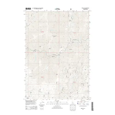
2013 Map of Pine Flat
USGS Topo · Published 2013About this map
The South Fork Payette River carves a deep path through the heart of the Boise National Forest, serving as a central corridor for recreational and geographical features in this Idaho territory. Along the river's northern banks, the confluence with the Deadwood River marks a significant hydrological junction, while the nearby Oxbow Bend illustrates the winding nature of the canyon floor. The landscape is defined by elevated plateaus and named benches, including Pine Flat, Birch Flat, and Pidgeon Flat, which provided accessible terrain for early development. Evidence of localized activity is found at the Pine Flat Hot Springs and several designated sites like the Deadwood Campground and Pine Flats Campground. Connecting these locations is the Banks Lowman Rd, which follows the river's contours, while more remote reaches are marked by prominent heights such as Burns Ridge and Windy Point.
Find a feature on this map
38 named features on this map. Tap any name to fly to it.
Don’t see what you’re looking for? This feature index may not catch every label — zoom into the map to look around manually.
Map Details
Editions of this 2013 Pine Flat Map
This is the sole edition of this map. No revisions or reprints were ever made.
Other maps of this area

1894 · Idaho Basin
USGS Topo · 1:125,000

1909 · Garden Valley
USGS Topo · 1:125,000

1955 · Hailey
USGS Topo · 1:250,000

1957 · Pioneerville
USGS Topo · 1:24,000

1957 · Challis
USGS Topo · 1:250,000

1959 · Hailey
USGS Topo · 1:250,000

1959 · Garden Valley
USGS Topo · 1:62,500

1960 · Challis
USGS Topo · 1:250,000

1962 · Hailey
USGS Topo · 1:250,000

1963 · Challis
USGS Topo · 1:250,000