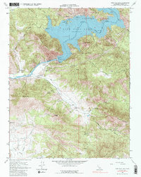
1965 Map of Pine Flat Dam
USGS Topo · Published 1986About this map
Pine Flat Lake dominates this mid-century landscape, its winding shoreline and recreation areas like Island Park Recreation Area and Lakeview Recreation Area reflecting a transformation from a river canyon to a major water management hub. While the massive Pine Flat Dam stands as the primary engineering feat, traces of an older world remain at Hughes Creek Cemetery and the settlement of Piedra. This survey, based on 1948 topography captured prior to inundation, preserves the original course of the Kings River beneath the reservoir's surface. High peaks like Hughes Mountain and Tivy Mountain frame the valley, while the presence of a Lookout Tower and a Landing Strip near Mill Creek indicates the area's role in forest management and regional logistics during the mid-1960s.
Find a feature on this map
33 named features on this map. Tap any name to fly to it.
Don’t see what you’re looking for? This feature index may not catch every label — zoom into the map to look around manually.
Map Details
Editions of this 1965 Pine Flat Dam Map
3 editions found
Other maps of this area

1920 · Orangedale School
USGS Topo · 1:24,000

1921 · Squaw Valley
USGS Topo · 1:31,680

1922 · Trimmer
USGS Topo · 1:96,000

1923 · Orangedale School
USGS Topo · 1:31,680

1923 · Wahtoke
USGS Topo · 1:31,680

1924 · Citrus Cove
USGS Topo · 1:31,680

1924 · Dinuba
USGS Topo · 1:125,000

1942 · Watts Valley
USGS Topo · 1:62,500

1942 · Dunlap
USGS Topo · 1:62,500

1944 · Watts Valley
USGS Topo · 1:62,500