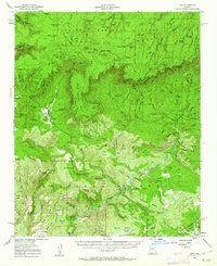
1952 Map of Pine
USGS Topo · Published 1962About this map
The Mogollon Rim dominates this mid-century landscape, marking a sharp topographic transition between the high Mogollon Mesa in the north and the complex canyon country of the Tonto National Forest below. The small settlement of Pine serves as a focal point for the region, complete with its local Cem and proximity to the Natural Bridge landmark along Pine Creek. This era of the survey reveals a mix of rugged back-country transit and early aviation, featuring the High Line Trail skirting the rim and the Birch Mesa Airport located near a secondary Landing Strip. Water sources are critical in this terrain, as evidenced by numerous named springs such as Fortyfour Spring and Clover Spring. The presence of the Summit Mine and isolated outposts like Chase Ranch highlight the enduring legacy of ranching and resource extraction in this corner of Gila County.
Find a feature on this map
119 named features on this map. Tap any name to fly to it.
Don’t see what you’re looking for? This feature index may not catch every label — zoom into the map to look around manually.
Map Details
Editions of this 1952 Pine Map
3 editions found

Other maps of this area

1887 · Verde
USGS Topo · 1:250,000

1892 · Verde
USGS Topo · 1:250,000

1923 · Camp Verde
USGS Topo · 1:125,000

1929 · Turret Peak
USGS Topo · 1:125,000

1932 · Camp Verde
USGS Topo · 1:125,000

1933 · Turret Peak
USGS Topo · 1:125,000

1934 · Pine
USGS Topo · 1:62,500

1934 · Promontory Butte
USGS Topo · 1:62,500

1936 · Camp Verde
USGS Topo · 1:125,000

1936 · Payson
USGS Topo · 1:48,000