
1970 Map of Pine Grove
USGS Topo · Published 1974About this map
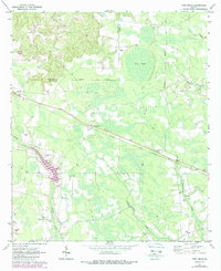
The Southern railway line cuts a distinct northwest-to-southeast diagonal through this South Georgia landscape, connecting the small settlements of Graham, Pine Grove, and Prentiss. This 1970 field-checked survey reveals a rural landscape defined by an intricate network of waterways and wetlands, notably Big Pond and the meandering courses of Bishop Creek and Sweetwater Creek. The settlement pattern is characterized by numerous community hubs, with local history centered around landmarks like Oakview Ch, Big Oak Ch, and Friendship Ch.
Find a feature on this map
26 named features on this map. Tap any name to fly to it.
Don’t see what you’re looking for? This feature index may not catch every label — zoom into the map to look around manually.
Map Details
Editions of this 1970 Pine Grove Map
2 editions found
Other maps of this area

1953 · Waycross
USGS Topo · 1:250,000

1958 · Waycross
USGS Topo · 1:250,000

1970 · Baxley NE
USGS Topo · 1:24,000
1970 · Grays Landing
USGS Topo · 1:24,000

1970 · Baxley
USGS Topo · 1:24,000

1971 · Nicholls NE
USGS Topo · 1:24,000
1971 · Hazlehurst North
USGS Topo · 1:24,000

1971 · Alma NW
USGS Topo · 1:24,000

1971 · Hazlehurst South
USGS Topo · 1:24,000
1971 · Alma NE
USGS Topo · 1:24,000