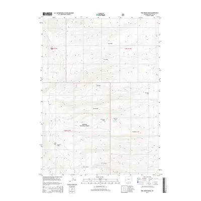
2015 Map of Pine Grove Ridge
USGS Topo · Published 2015About this map
Bridger National Forest encompasses much of this high-elevation landscape in Sublette County, where the terrain is defined by a series of prominent north-south oriented ridges. Central to the geography is Pine Grove Ridge, accompanied by Narrow Ridge and Lake Ridge, which dictate the drainage patterns for numerous seasonal and perennial streams. Small-scale water management is evident at the Pine Grove Reservoir, which sits near the head of Pine Grove Draw. The western portion of the map is dominated by the steep ascent toward Deadline Ridge and Bald Knoll. This area serves as a rugged corridor for local ranching and transit, anchored by the Black Canyon Rd which follows the path of Black Canyon and its namesake creek. The map captures a backcountry environment where land use is dictated by the dramatic verticality of features like Reed Ridge and Trail Ridge.
Find a feature on this map
28 named features on this map. Tap any name to fly to it.
Don’t see what you’re looking for? This feature index may not catch every label — zoom into the map to look around manually.
Map Details
Editions of this 2015 Pine Grove Ridge Map
This is the sole edition of this map. No revisions or reprints were ever made.
Other maps of this area

1921 · Afton
USGS Topo · 1:125,000

1936 · Cokeville
USGS Topo · 1:96,000

1939 · Big Piney
USGS Topo · 1:125,000

1942 · Cokeville
USGS Topo · 1:125,000

1942 · Big Piney
USGS Topo · 1:125,000

1955 · Preston
USGS Topo · 1:250,000

1958 · Preston
USGS Topo · 1:250,000

1962 · Preston
USGS Topo · 1:250,000
1967 · Coal Creek
USGS Topo · 1:24,000

1967 · Mount Thompson
USGS Topo · 1:24,000